

photo by Will Stoeger
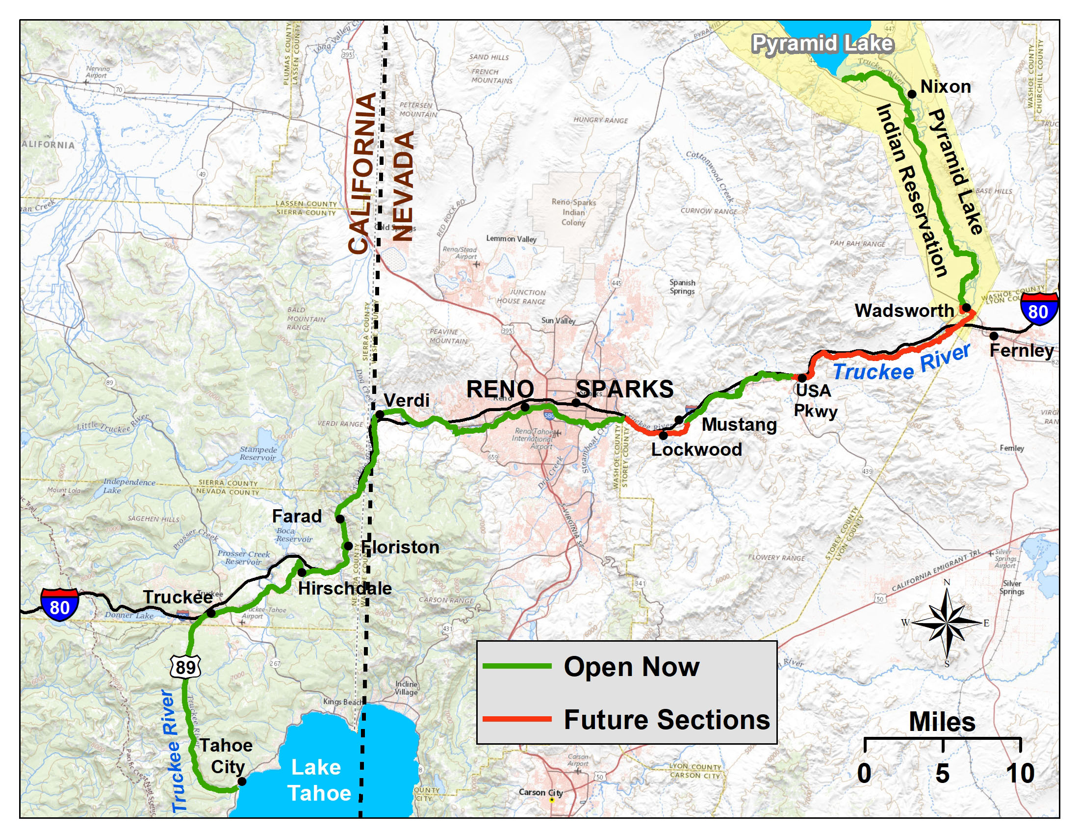
There are five sections of the Tahoe-Pyramid Trail currently open to hiking and cycling.
In urban areas, the trail is paved (Tahoe City to Hirschdale and through Reno-Sparks), but in other areas it is dirt. For the dirt sections, intermediate riders should plan on using mountain bikes or fatter-tired gravel bikes (advanced riders may be OK with cross bikes).
Important Note 1: Each Trail Section page also includes it’s own “CURRENT TRAIL CONDITIONS” list of any known current trail issues for that individual section. These may include trail issues such as closures, detours or other problems that are important for trail users to know ahead of time.
Important Note 2: Some trail sections are very remote with no trail-side services of any kind. It is important to be aware of your surroundings, carry adequate water and apparel for the season and be sure your cell phone is fully charged before heading out (Many trail users on the remote sections carry a supplemental external battery to charge their phone on the go). Please note too that the most remote sections of the trail may or may not have cell service which also depends on your individual cell carrier service area.
Tahoe-Pyramid Trail Maps
Find detailed trail maps, including PDFs, GPX files, RideWithGPS, and Google Maps, as well as trail photos and additional trail section information on each of the Trail Section Pages
Each Trail Section Page also contains the following information:
- Any Current Trail Section Advisories (Warnings, closures or detour information, etc.)
- Trail Section Description
- Trail Difficulty
- Services available along the trail section
- What the Trail Section connects to (other trail systems)
- Recommend Bikes for the Trail Section