Add Your Tooltip Text Here
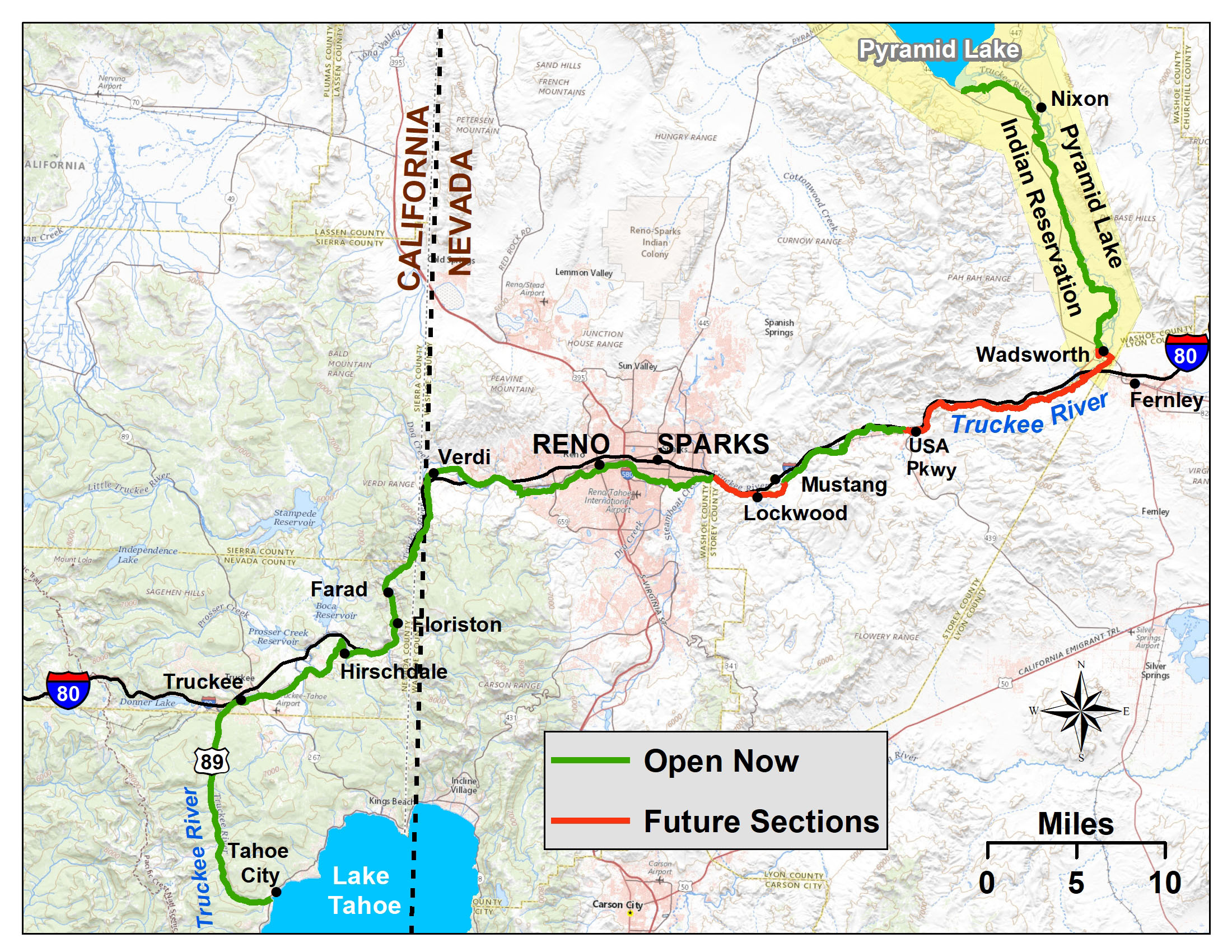
Tahoe City – Hirschdale Overview & Section Maps
Current Active Trail Section Alerts
There Are Currently No Active Trail Alerts For This Trail Section
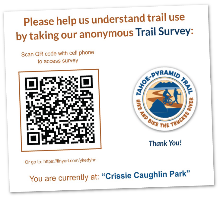
u003cstrongu003ePlease Take Our New Trail Surveyu003c/strongu003eu003cemu003eu003cstrongu003e u003c/strongu003e (Click to Learn More)u003c/emu003e
Please Take Our New Trail Survey!
(One of the temporary trail signs shown above)
And a huge THANK YOU to Prof. Ken Nussear and the Geography students at UNR for helping with this project! Your efforts are greatly appreciated!
Why a Trail Survey? To help us better understand trail activities & usage:
- Hiking? Running? Cycling? Wildlife viewing? Fishing? Commuting? Strolling? We want to know!
- Favorite sections of the trail? Please let us know...
- Your access and parking? Miles traveled? That too!
- And more...
The survey is short & anonymous. The results will help us to: A) Obtain more funding (grants and donations), and B) Better support the needs of all trail users!
Click on the individual map sections for more detail
Tahoe City – Hirschdale Navigation Maps
NOTE: You may need to give permissions in your phone settings for the map & apps to use your location.
From Tahoe City:
Downstream to Hirschdale
RideWithGPS | GPX File Download
From Hirschdale:
Upstream to Tahoe City
RideWithGPS | GPX File Download
Tahoe City – Hirschdale Trail Section Details
Trail Description:
Tahoe City to Hirschdale is a combination of separate multi-use paths, wide highway bike lane, street, regional trail and finally road. All of it is paved. Overall it is 23 miles from Tahoe City to the Hirschdale Truckee River Bridge.
The Trail starts with a paved separate multi-use path from Tahoe City to Squaw Valley (5 miles) which is heavily used in the summer. At Squaw Valley the trail transitions to a wide bike lane alongside Highway 89 to Truckee. In Truckee, the use of West River Street and Bridge St / Brockway Rd connects with the Truckee Legacy Trail to Glenshire. Following Glenshire Drive leads downhill to Hirschdale and the Truckee River Canyon. The gradient of the Tahoe City to Hirschdale section is very gradual to nearly flat except the last section that climbs to Glenshire Drive then downhill to Hirschdale road and the Truckee River bridge.
The trail from Tahoe City to Truckee has been developed over the years by the North Tahoe Public Utilities District, Placer County and the Town of Truckee.
Trail Difficulty:
The section of the trail between Tahoe City and Squaw Valley Rd. is 100% bike path so it is suitable for all riders. This section is popular with walkers and runners though so please ride with caution.
The section of the trail between Squaw Valley and Hirschdale consists mainly of paved roads shared with cars so riders should be comfortable riding with traffic. See PDF maps above for more details.
Recommended Bikes for this Trail Section:
Road, Hybrid, Touring or anything really.
Current Trail Conditions
Since the trail is largely paved bike paths and shared-use paved roads, there is a chance for road debris, potholes, and potential construction. Please always use caution.
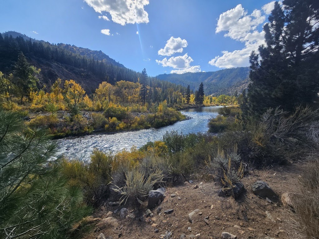
Photos of the Tahoe City – Hirschdale Trail Section


This Trail Connects to:
At Tahoe City, other paved bike paths follow the shore of Lake Tahoe in both the southern and eastern directions. In addition, a connection can be made here to the Tahoe Rim Trail.
In Truckee, there is a network of paved and unpaved trails provided by the Town of Truckee, as well as a popular road ride over Donner Summit on Old Highway 40 to Cisco Grove.
Services
There are abundant lodging and food services in Tahoe City, Squaw Valley, and Truckee, as well as bike shops.